Teatown Lake Reservation — From 2022 to Two Million Years Ago

 I can’t quite believe it’s taken me this long to write about Teatown Lake Reservation

Talk about ignoring things in your own backyard! It’s not only a wonderful organization that has provided exemplary stewardship of the land, but it’s also a goldmine of history.  

If you know where to look, of course.

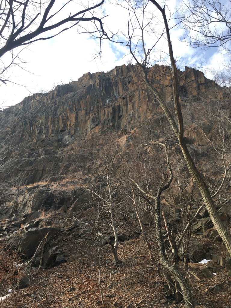
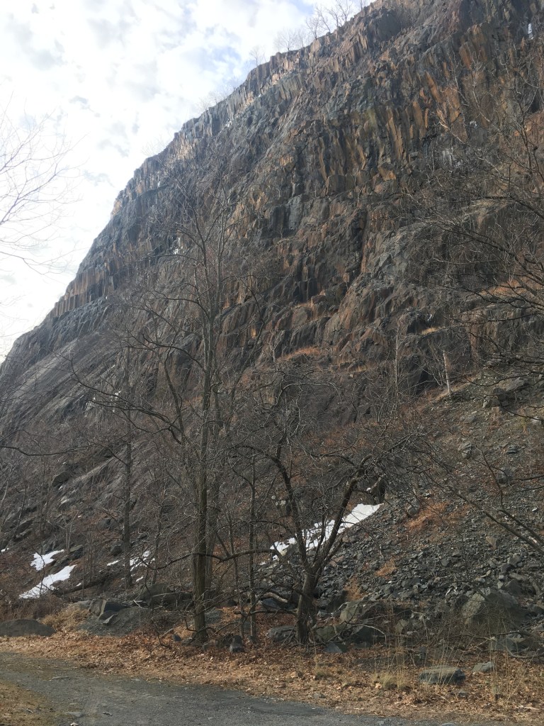
Now, I have of late become  a little more interested in pre-history – I mean geologic history, the kind that involves rocks and . . . well, rocks.  It is truly the history before humans.  See here for more. 

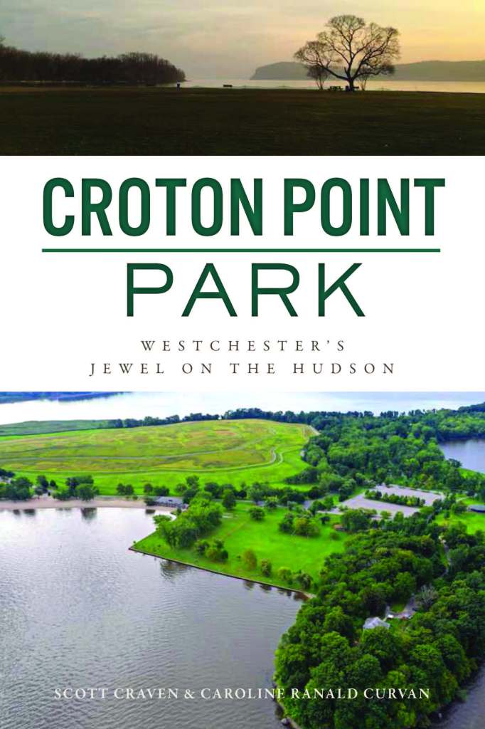
(Also, see the first chapter of my new book Croton Point Park: Westchester’s Jewel on the Hudson)

But I’m not going to go back to the Precambrian epoch.  I mean, I could tell of gneiss and schist and Ossining marble, of ancient continental plates, ever shifting and buckling up mountain ranges.  Of Pangaea and volcanoes and ice sheets . . . but already, I feel your attention begin to wane. 

No, I have to admit that my interests lie in people – how they lived, what they ate, what they wore, what they did.  How different yet similar we are.  And, of course, how we got to where we are today.

Teatown has all of this – characters and stories, and a long, long history that can indeed be traced back to rocks and magma.

So let’s start from today, and go backwards, investigating the world of Teatown from 2022 all the way back to – well, I guess the history of the rocks and ice I disparaged above.  Or at least until I get bored.

First, no discussion of Teatown would be complete without calling attention to Lincoln Diamant’s excellent book, Images of America: Teatown Lake Reservation. 

 You can find it in our local libraries, pick it up at the Teatown gift shop, at any number of our local bookshops or, if you must, buy it online.  

(Full disclosure, I have plucked much of my research for this post out of Diamant’s book.)

So, what is Teatown?  (And how did it get its name?)

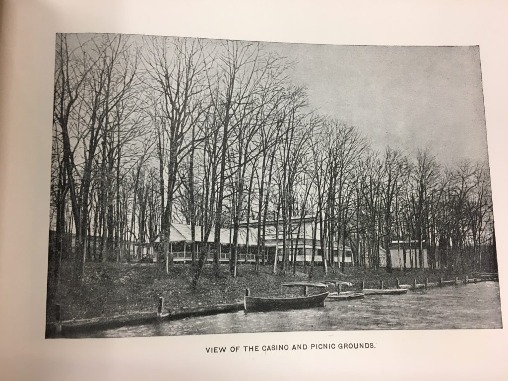
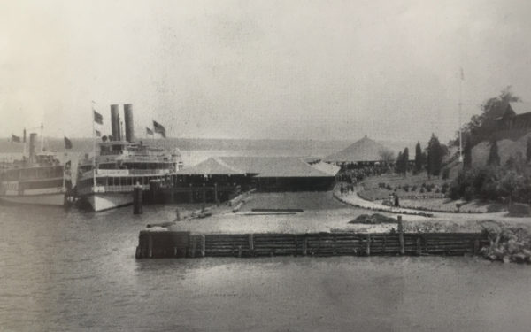
Today, 2022, Teatown Lake Reservation is a non-profit nature preserve with miles of trails, native plant exhibits, and a small wildlife refuge.  Much of the land that constitute today’s Teatown was owned by Gerard Swope, Sr. and his wife Mary and inherited by their five children. They created Teatown Lake Reservation in 1963 to honor their parents and it has been thriving and growing ever since.

Gerard Swope was president of General Electric from 1922 – 1945 and was a well-respected businessman and labor reformer.  He also worked in the Roosevelt administration during the Depression to aid with the economic recovery.  

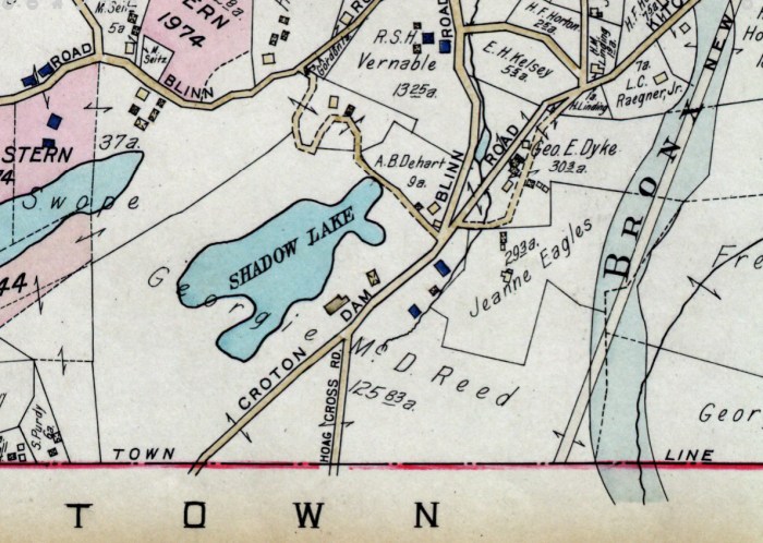
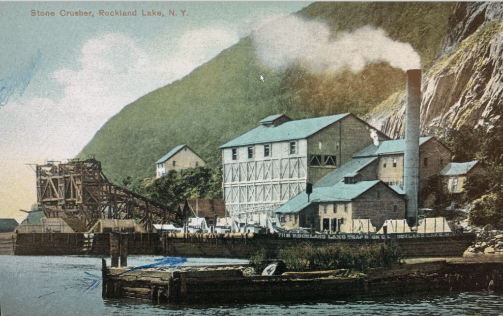
In 1922, Swope purchased the main house, the outbuildings and various parcels of land from the estate of Dan Hanna.   In 1924, the Swopes created Teatown Lake, by building the small dam still found at the far side of lake.  

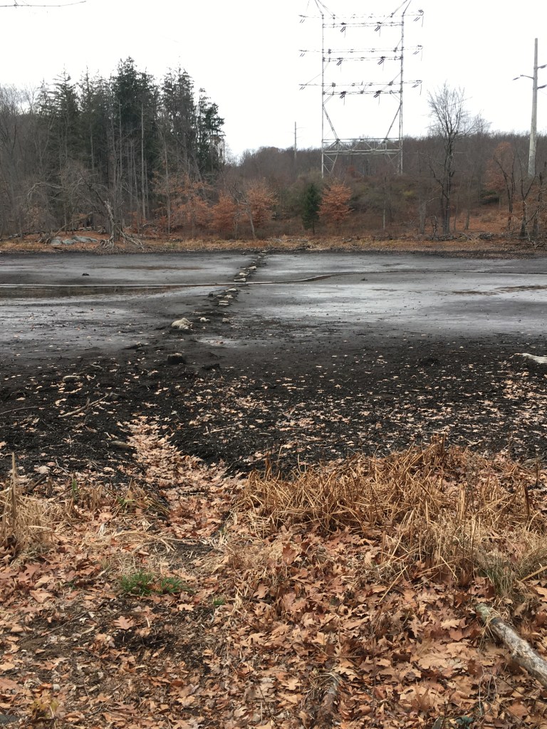
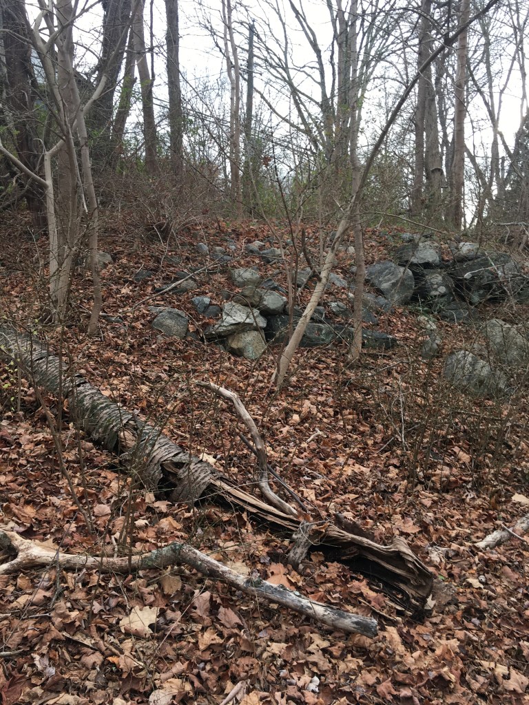
I must note that from October – December 2022, Teatown had to do some extensive rebuilding of the dam and in the process, drained the entire lake.  Here are some photos and look – you can see the remains of 18th/19th century stone walls still stuck in the mud.  

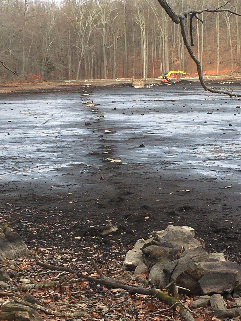
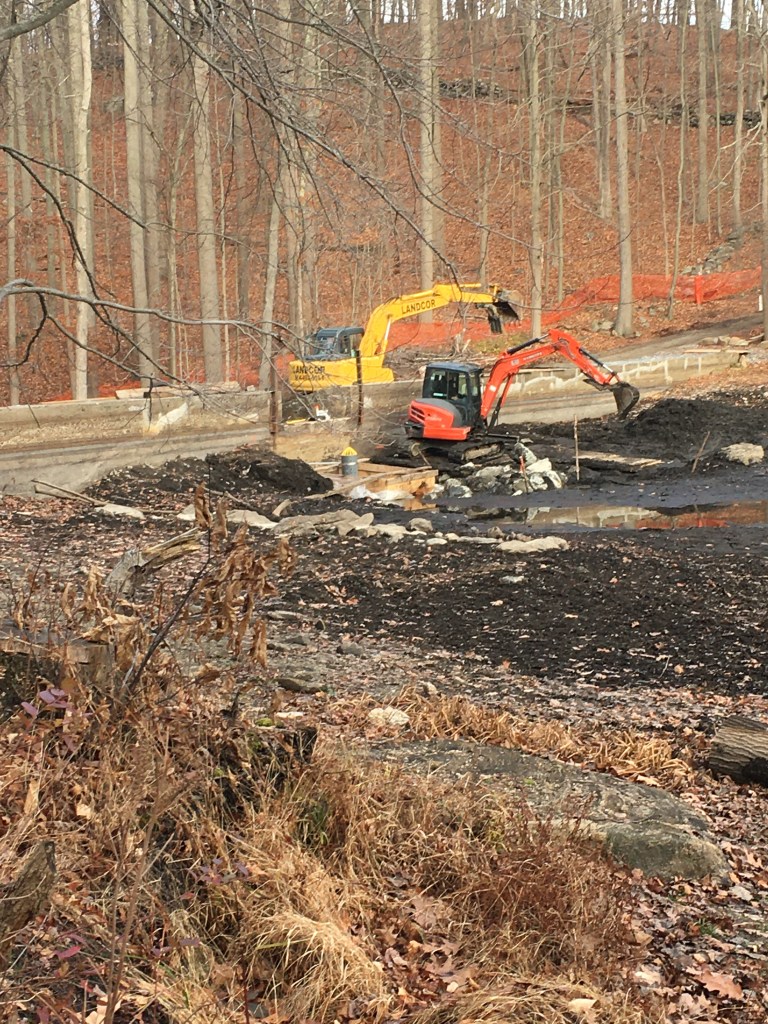
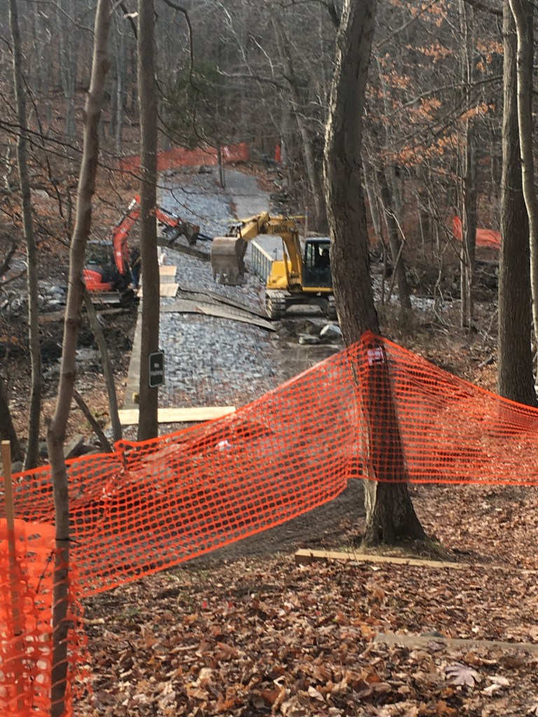
And here are some pictures of the diggers and backhoes at work rebuilding the dam and installing a new pump.  

But back to the exciting title search — in 1919, Dan Hanna purchased the land. He was the owner and publisher of the Cleveland News, as well as being a coal industrialist from the Ohio region.   If you’re a serious political history buff, you might find it interesting to learn that he was the nephew of Ohio Senator Mark Hanna, the Karl Rove (or Kellyanne Conway) to our 25th President, William McKinley.  

Dan Hanna was referred to as a “Cleveland Millionaire,” in a 1916 New York Times squib about his third divorce.   (Is that a sniffy New York Times way of saying he wasn’t up to New York social standards?)  He then swiftly remarried Molly Covington Hanna in the same year.  There are other newspaper clippings I’ve seen that were positively salivating over his marital career (“Dan Hanna is some Marry-er” winked the Lexington Herald-Leader in December of 1916).

At his death in 1922, according to the New York Times, his estate was valued at $10,000,000.  He was also noted as having four infant sons.  Considering that he married Molly in 1916 and she was 47 at the time, that is either surprising or simply incorrect. Yet this curious 1923 article describes a chaotic life after she was widowed, despite the 978 acre estate on Makeenac Lake in the Berkshires that she received as a wedding gift from Hanna.

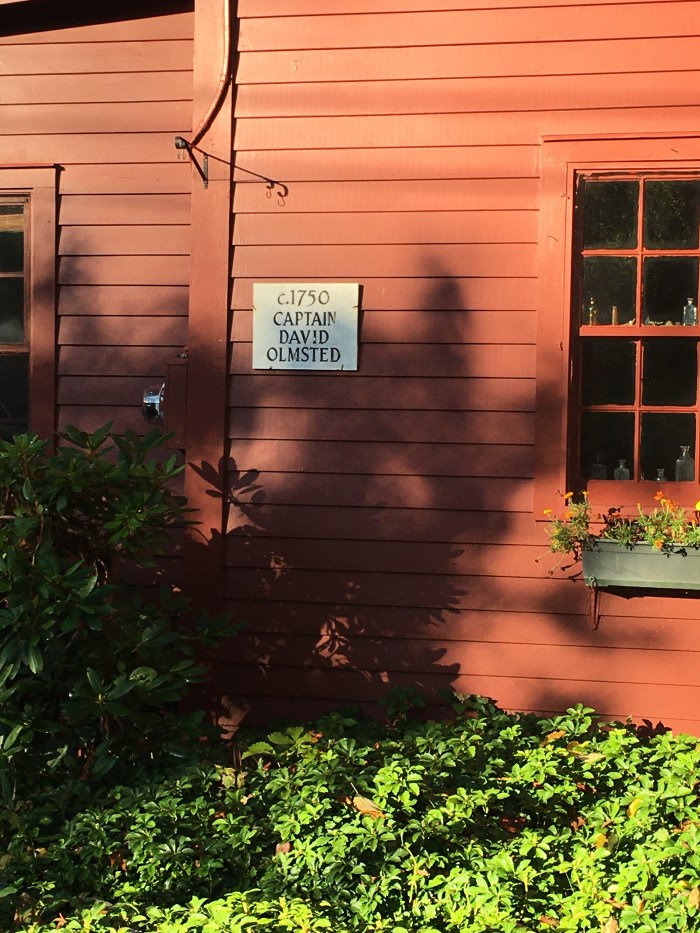
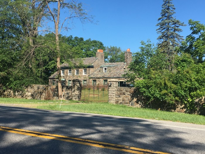
Continuing on back in time, the previous owner, Arthur Vernay, purchased the parcel in 1915 from the Hershfeld estate.  Vernay was one of those wealthy men with a fascinating variety of interests and hobbies – apparently he was a very successful antiques dealer in Manhattan who was also an enthusiastic big-game hunter in the style of Teddy Roosevelt (and who also donated many carcasses to the Museum of Natural History.  Apparently you can still find his name on a plaque in the Roosevelt wing there today.)  

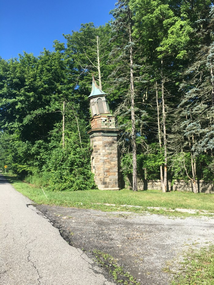
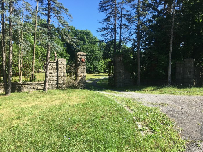
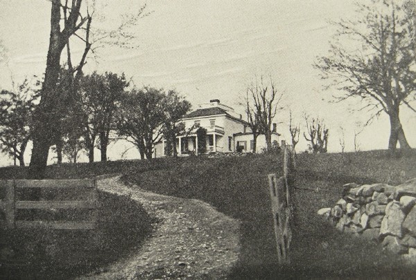
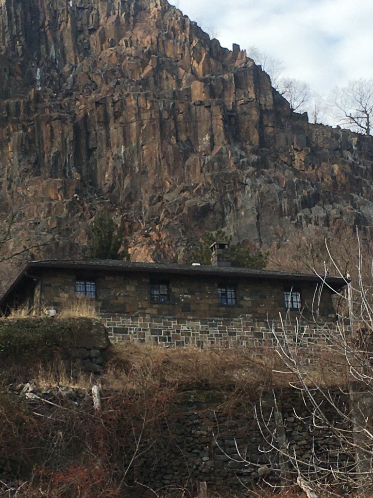
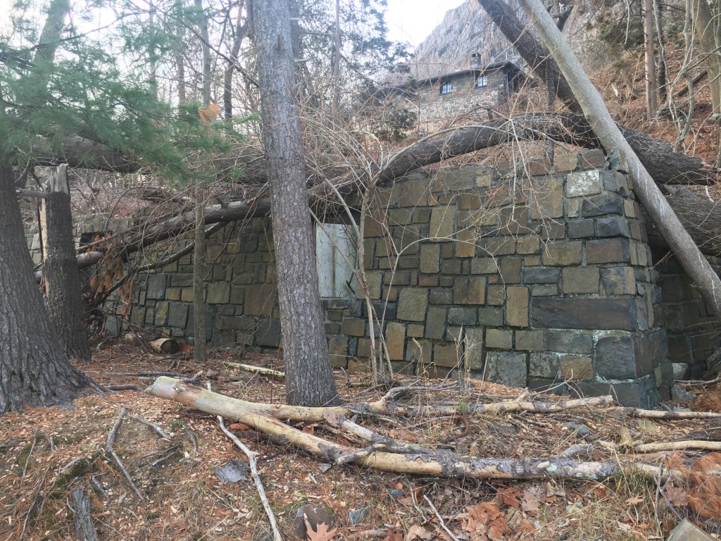
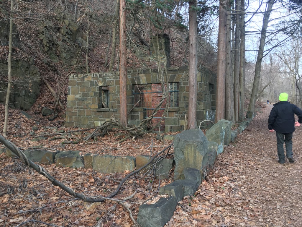
Vernay was responsible for building many of the Tudor-style structures that still stand today.  Those office buildings by the parking lot?  These were the old stables and outbuildings of the Croft, Vernay’s matching Tudor-style mansion that stood across the street until it was demolished in 2019.  The Croft supposedly contained imported genuine antique English interiors (a fireplace in there was said to be from the 1300s!)  I mean, considering that Vernay dealt in antiques, that seems possible.

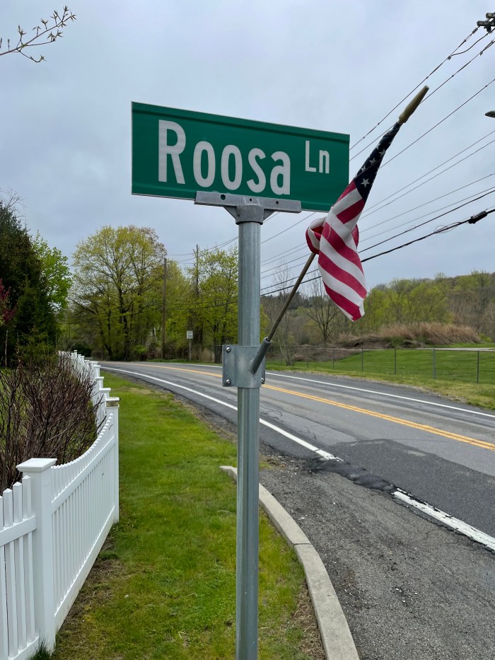
Now, here’s where it gets complicated.  Before 1915, Teatown was part of a series of parcels that had at one time all been owned and farmed by the Palmer family.  The Palmer connection goes back to 1780, when William Palmer purchased a fairly large tract of land from Pierre Van Cortlandt.  Palmer lived at 400 Blinn Road (so named in the 20th century by actor Holbrook Blinn) and seems to have run a successful dairy farm. (Lincoln Diamant says that #400 was a converted dairy barn. But Diamant also says that #400 was a house built by the Van Cortlandt’s in 1740.  I’d be interested to know which is the truth.) 

In 1826, William Palmer gives several plots of land to his son Robert, who would build himself a farmhouse nearby at 340 Blinn Road.

A few years later, William Palmer would give another plot to his son John, who apparently lived in a farmhouse on or near today’s Teatown administration building.  His barn is said to have been on the site of the maple sugaring shed.  And the lake?  That wasn’t there at all – it was in fact a Big Meadow (so noted on maps of that era.)

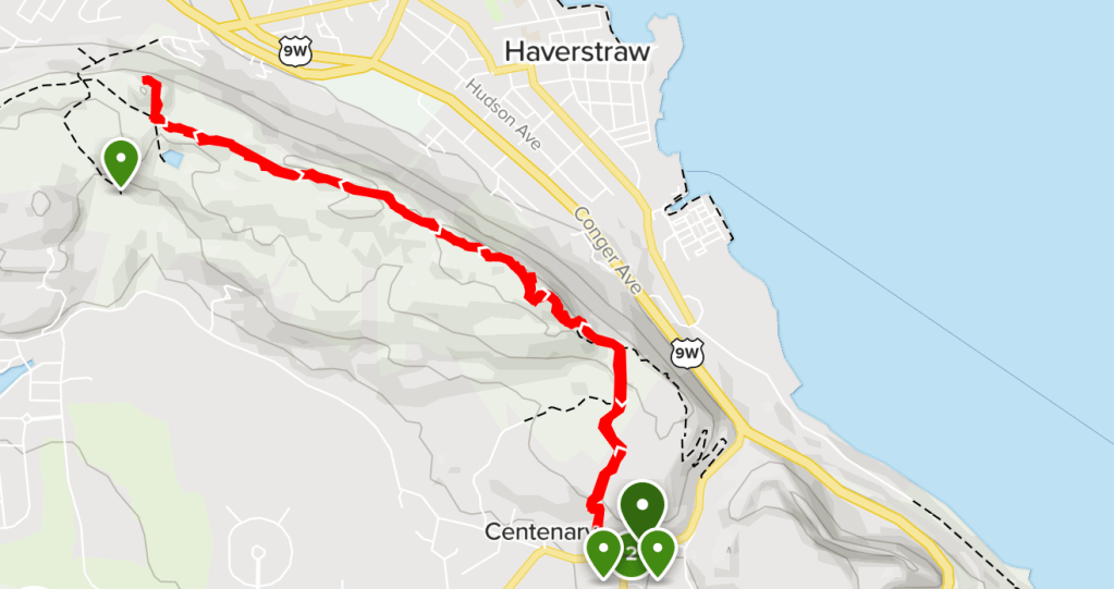
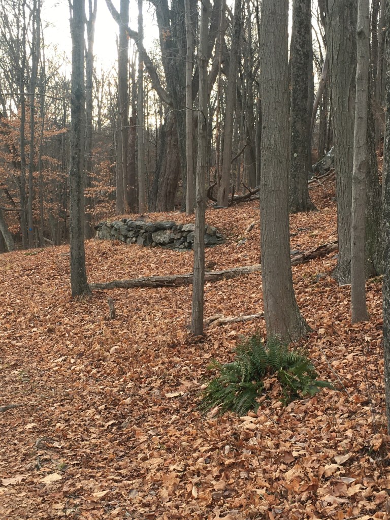
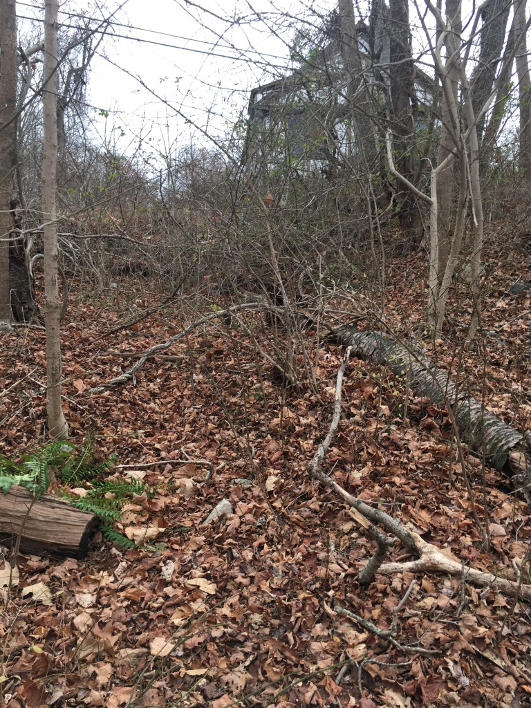
At some point, son (or grandson?) Richard Palmer also received a plot of land – this one all the way over by Teatown Road.  In fact, if you walk along the Lakeside Trail, crossing the two Eagle Scout-built bridges built by Troop 18 scouts Michael Pavelchek and William Curvan . . .

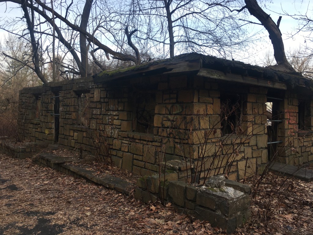
. . . you’ll eventually come upon some crumbing stone foundations which are all that’s left of Richard Palmer’s farmstead.  The buildings were supposedly standing until 1915, and I have even heard that daylilies are still seen to bloom at the site on occasion (though I’ve never managed to see any.) 

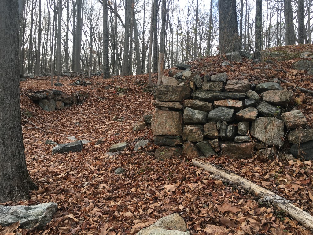
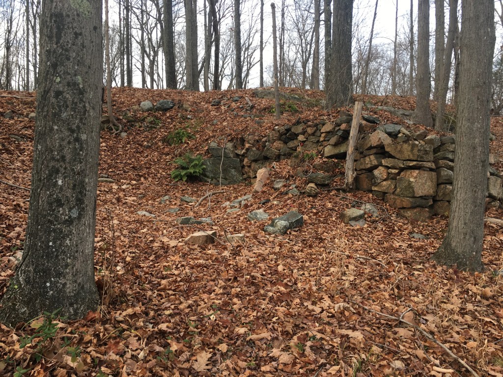
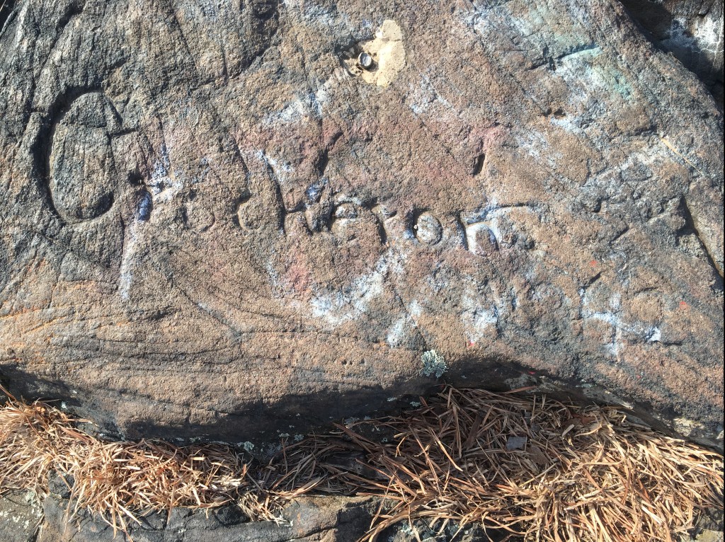
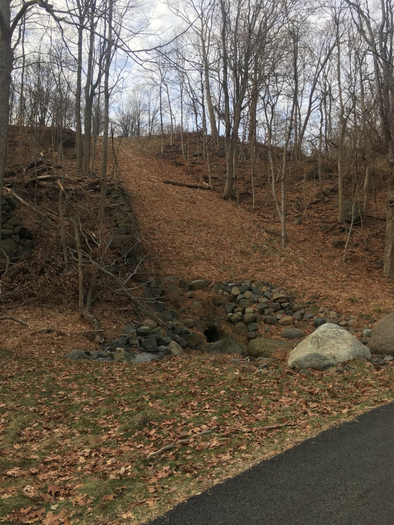
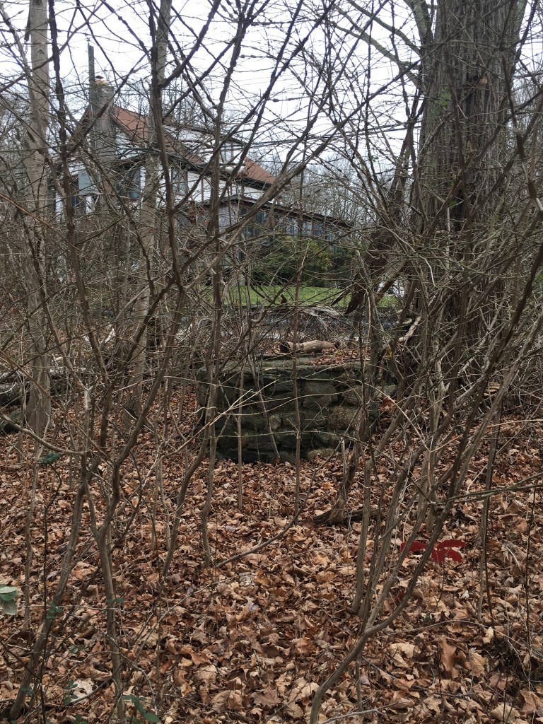
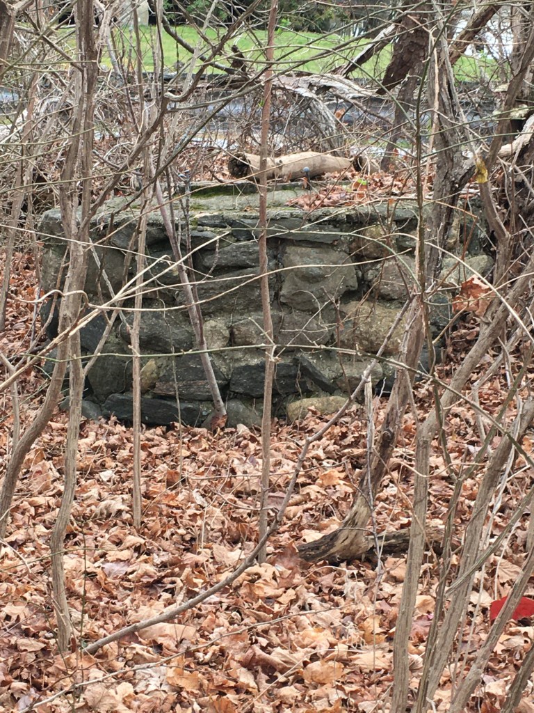
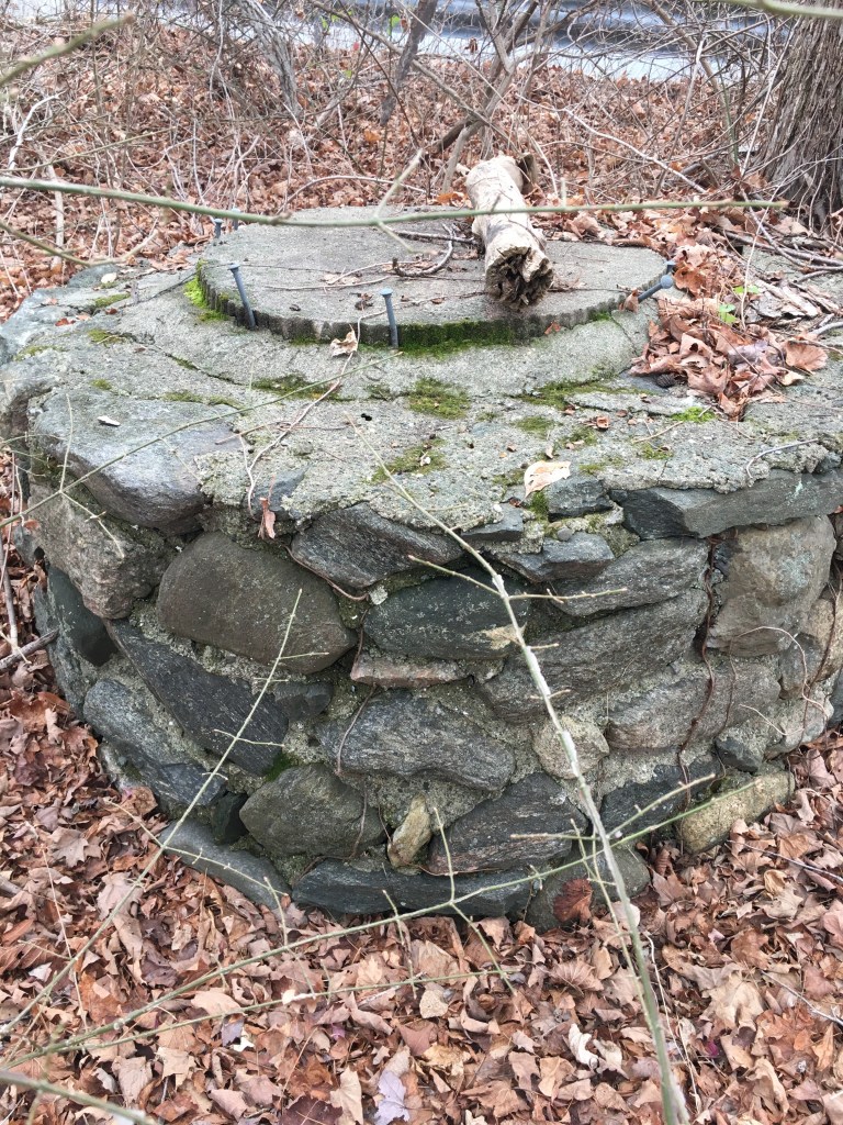
Other plots of land were sold to non-Palmers, one of which still whispers to us when the leaves are down.  As you’re walking on the Lakeside Trail, right next to Spring Valley Road, you might notice a pile of stones.  These are the foundation of Kahr’s farmhouse, located at 1685 Spring Valley Road.  

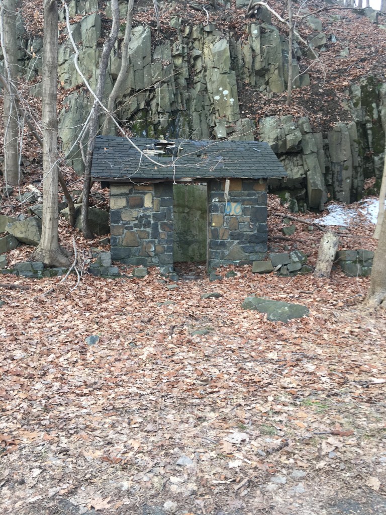
And if you walk a little farther and look carefully, you can even see what I believe is the original well for this farmhouse:

Are your eyes glazed over yet?  Stay with me a bit longer and I’ll tell you how it got its name AND make the connection all the back to the first people – I’ll be quick, I promise!

How did Teatown get its name?

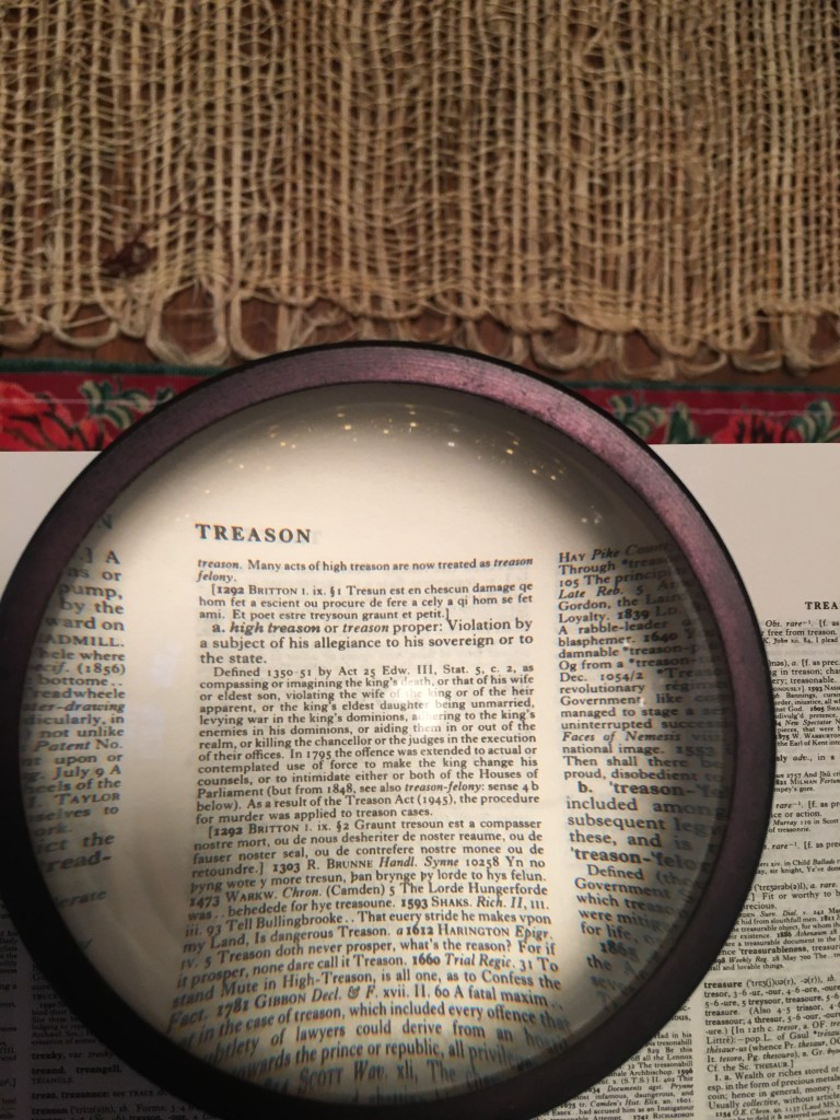
The story goes (and it comes from the aforementioned Mr. Diamant) that during the American Revolution a grocer named John Arthur moved up from British-controlled Manhattan to the Neutral Zone of northern Westchester.  Gossip ensued, and it was bandied about among the local women that Mr. Arthur had several chests of tea in his possession.  Now tea was as precious as gold then (remember the Boston Tea Party??) and Arthur was a prudent businessman who hoped to sell his tea for whatever the market would bear.  Well, this market of tea-deprived farmwomen was no match for him – they ransacked his farmhouse and found the tea.  He finally agreed to sell it to them for a reasonable price and so Teatown was born.

(I will not waste words poking holes into this story as I do not have a better one to offer in its place.)

Moving still further backwards . . .

In 1697 Stephanus Van Cortlandt is awarded a royal patent from King William III for 86,000 acres that ran from today’s Van Cortlandt Manor in Croton all the way up to Anthony’s Nose and inland almost to Connecticut.  Stephanus died in 1700 and it was up to his widow Gertrude and about 100 tenant families to farm and maintain the land.  (Well, I’m pretty sure Gertrude wasn’t doing any hoeing. . .)

Now, before 1609, when Henry Hudson sailed his Half Moon up the river, the area was home to Algonquin-speaking indigenous people related to the Mohicans, Munsees, Wappingers and Delawares.  The Sint Sincks and the Kitchawan were two tribes that likely used the Teatown area as their hunting grounds.  

It’s not entirely clear to me when/how Stephanus Van Cortlandt wrested the land away from the Indians. I have not researched this thoroughly, so can’t say whether or not there’s a “deed of sale” exchanging some rifles, kettles, trade cloth and tankers of rum for the land in the 1680s or so.

Going back even farther, say about 10,000 – 15,000 years ago, people were following the retreating glaciers and first coming into the area from the south and the west.  

Think about that — our area has only been habitable fairly recently.  Consider that the most recent ice age, of the Quaternary Period, began over 2 million years ago and it wasn’t until about 25,000 years ago that humans and animals could even have survived.  It is, as Town of Ossining historian Scott Craven likes to say, just a geological snap of the fingers!

So there you have it – a thumbnail history of Teatown from November 2022 to 2 million years ago.  While this is by no means in-depth reporting, I hope it will inspire you to dig deeper.

A Shameless Plug . . .

I know I haven’t posted much here lately and that’s because I was putting the finishing touches on my new book!

Co-authored with Town of Ossining Historian Scott Craven, it’s called “Croton Point Park: Westchester’s Jewel on the Hudson.” Here’s the cover for your enjoyment:

It’s a fairly comprehensive history of (duh!) Croton Point Park, starting about 25,000 years ago when the ice sheets began their final retreat north. We’ve been getting great feedback on it from people who’ve read it and/or seen one of our presentations.

So check it out! You can buy it at any bookstore in the immediate area, as well as from the usual online bookselling sites. (You can even purchase a Kindle version!)

And please, visit our website: HudsonValleyChronicles.com — you can find other links through which you can purchase the book and read our new Hudson River blog over there.

Thanks for your support!

Ossining War Casualty – Private Elting W. Roosa, 1896 – 1918

Ossining War Casualty –  Private Elting W. Roosa, 1896 – 1918

Continuing my investigation into the stories behind the Ossining streets named after veterans, today’s post begins with Roosa Lane.

Roosa Lane, off Hawkes Avenue, Ossining. Photo by John Curvan

Now, as you will note, Roosa Lane does not have a star on it as other street signs do, but it DOES have a flag.  While I’m still researching this, I believe the older streets (such as Feeney and Bayden for example) have the star while more recent ones, like Roosa, are demarcated with a flag.  

Roosa Lane is named after Private Elting W. Roosa, who died in France on October 25, 1918, just about two weeks before the Armistice.  He was a member of the 105th Co. Medical Training Division, 27th Division at the time of his death.

Private Elting W. Roosa. Photo from the Columbia University Libraries

Roosa was born on July 11, 1896, in Kingston, New York, to William and Mary Roosa.  The family moved to Ossining sometime after 1905 and lived at 4 Church Street, aka the Rowe building.

4 Church Street, c. 1910. Photo Courtesy of Dana White/Ossining Historical Society

Later, they moved to 11 Independence Place in Ossining.  According to the 1914 Ossining City Directory, 18-year-old Elting Roosa was working as a clerk (father William was a carpenter.)  But the next year, Elting enrolled in Columbia University’s School of Pharmacy, graduating in 1917.[i]  Just before he graduated, in April of 1917, he joined the NY National Guard’s 102nd Sanitary Train, composed of ambulance and field hospital companies.

Upon graduation, Elting had quickly found a job as a pharmacist, in Tarrytown at Russell & Lawrie. (Fun fact, if they are not still in existence as of 2022, they were until very recently.) But he was drafted in June, and by July, Private Roosa and the rest of the 27th Division went down to Camp Wadsworth in Spartanburg, South Carolina for training. Just less than a year later, on June 30, 1918, he was sent overseas on the USS Huron and arrived in Brest, France – one of the last of his division to arrive.

I haven’t been able to confirm exactly what he did overseas – I’ve learned that many US Army personnel records spanning the years 1912 – 1963 were destroyed in a 1973 fire, so perhaps that accounts for the lack of information.[ii]  

However, I think it’s likely that Roosa may have served as a medic, an orderly or perhaps even a pharmacist.  But even in those few months that he was overseas, he must have seen plenty of the horrors of war. His Division, the 27th, was involved in the last, great push of the War, the Meuse-Argonne Offensive on the Somme that took place from September 24 – October 1.

Over one million US soldiers participated in this battle and over 26,000 died.  

But our Private Roosa didn’t die in battle – no, he died of pneumonia.  Remember, at this time, the Great Influenza was ravaging armies in the US and across Europe.   And the Battle of Meuse-Argonne happened just as the second, most deadly wave of the influenza epidemic was peaking.  According to an article published by the National Institute of Health (NIH) entitled “Death from 1918 pandemic influenza during the First World War: a perspective from personal and anecdotal evidence,” there were over 100K troop fatalities all told due to influenza at this time.[iii]

Further, the article details reports made by Colonel Jefferson Kean, the Deputy Chief Surgeon of the Allied Expedition Forces based in France.  On September 18, 1918, he wrote of a “Sudden and serious increase in influenza-pneumonia.”  By October 6, he was reporting that “Influenza and pneumonia . . . increased by thousands of cases.  Case mortality of pneumonia 32 percent.”  The next week, it had increased to 45%.  

It was right about this time that our Private Roosa must have contracted what was likely influenza-pneumonia, dying shortly thereafter.  As Sister Catherine Macfie observed at her field hospital in nearby Lille, France: “The boys were coming in with colds and a headache and they were dead within two or three days.  Great, big handsome fellows, healthy men, just came in and died.  There was no rejoicing in Lille the night of the Armistice.”[iv]

A surprising fact I uncovered was that while about 53,000 American soldiers died in combat in WWI, approximately 45,000 additional US soldiers died of influenza and pneumonia. It’s very hard to get one’s head around those figures.

Another surprising fact is that Private Roosa was buried three times – below are the cards for his burials and disinterrments.  

From the Records of the Quartermaster General, Card Register of Burials of Deceased Soldiers,
1917 – 1922, National Archives

This intrigued me, so I did a deep dive and learned that the odyssey of Private Roosa’s remains illustrates two stories: one, the development of how America would treat its battlefield dead going forward, and two, the political nightmare the repatriation of the US war dead was to become.

WWI was the first time the US Government attempted the repatriation of its fallen soldiers, but then of course this was the first time they had sent so many overseas to fight in a war. (Up until the 20th century, casualties of war were buried more or less where they fell.)

But after WWI ended, many families wanted their sons (and daughters – let’s not forget the 400+ American nurses who died during this war) to come home.

Though former President Theodore Roosevelt, whose son Quentin’s plane was shot down in July 1918 over the Marne, publicly announced that he wanted his son to remain where he fell, his sentiment was in the minority.

So, the Graves Registration Service (GRA) took on the tremendous project of determining what families’ wishes were and fulfilling them.  To this end, over 74,000 postcards were sent out to the families of fallen soldiers asking if they wanted their remains repatriated.  Ultimately, over 44,000 bodies were shipped home for burial. 

But at the Armistice (11/11/1918), there were over 23,000 burial sites across the war zone. To accomplish their task, the GRA had to consolidate and relocate, establishing 700 temporary cemeteries for this purpose.  

This likely explains why Private Roosa was first buried in a British cemetery in Maissemy, then disinterred and reburied about a year later in an American cemetery, that would be known as Flanders Field.

One thing I think is worth mentioning is that at that time, the US Army was still segregated.  And this task of exhuming thousands of bodies was primarily assigned to the Black labor battalions. [v] This picture, from the National Archives and Records Administration, shows soldiers at work in the Ardennes, France.

Photo courtesy of the National Archives and Records Administration

In 1921, Private Roosa’s remains were exhumed and transported back to the States on the USS Cambrai, leaving Antwerp, Belgium on March 21, and arriving in Hoboken, NJ on April 3. (Ossining’s Sergeant Joseph De Barbiery arrived in Hoboken three months later, in July, 1921.)

I also learned that France, desperate to recover from four years of brutal war that had destroyed its farms, towns and cities, not to mention an entire generation of young men, was not terribly enthusiastic about devoting its limited resources to the transport of the dead while its living were in dire need. They also didn’t want the sight of coffins to further traumatize its citizens. So it took several years of diligent diplomacy to make all the necessary arrangements for the 44,000 soldiers whose families wanted them home.vi

Caskets waiting for transport in Antwerp, Belgium, 1921. Photo courtesy of the US Army Signal Corps.

I have found no record of a funeral for Private Roosa, but he lies buried in Ossining, in Dale Cemetery, next to his mother and father and not too far from the street that bears his name today.

Photo by Caroline Curvan

[i] https://library.columbia.edu/libraries/cuarchives/warmemorial/world-war-i/roosa-elting-w.html

[ii] https://www.archives.gov/publications/prologue/1998/fall/military-service-in-world-war-one.html)

[iii]  https://www.ncbi.nlm.nih.gov/pmc/articles/PMC4181817/  

[iv] https://www.ncbi.nlm.nih.gov/pmc/articles/PMC4181817/  

[v] https://www.washingtonpost.com/history/2021/05/31/world-war-i-exhumed-memorial-day

[vi] https://digital.library.unt.edu/ark:/67531/metadc804852/m2/1/high_res_d/thesis.pdf

Ossining War Casualty — Corporal Nathan Bayden

As promised, here’s a post with information on Corporal Nathan Bayden, one of Ossining’s war veterans, honored at the intersection of Feeney Rd. and Bayden Rd.

While Private Benjamin Feeney lost his life in WWI (see full blog post here), Cpl. Nathan Bayden served in WWII and was killed in action in Algeria.

(I do rather wonder how these street names honoring our soldiers are chosen, as this seems a particularly random pairing.) 

Nathan Bayden was born in Ossining on July 21, 1918.  His parents, Benjamin and Fannie, were born in either Poland or Russia (hard to know back then as the borders kept shifting.) The family was Jewish.  

He graduated from Ossining High School in 1935 and immediately went to work, likely as a clerk in his parents’ antique store which they ran out of their house at 107 Spring Street.  

According to the 1940 census, he was a chauffeur, and worked 52 weeks a year, earning the princely salary of $700 a year.  (That works out to about $20,000/year today.)  

Not sure if Nathan was drafted or if he joined up voluntarily, but he officially enlisted on March 5, 1941.  His enlistment record notes that he was a “salesperson”, not a chauffeur, and at the time he enlisted, he wasn’t assigned to a particular service branch at the time.  

At some point, though, he became part of the US Army, 2nd Armored Division, 67th Armored Regiment.

The nickname for the 2nd Armored Division was “Hell on Wheels” and their shoulder patch looked like this:

If you look closely at Corporal Bayden’s picture above, you can see that same patch on his left shoulder, confirming his Division.

I can’t find out when he joined the 2nd, so I’m not sure which battles he fought in, except for his last.  Killed in Action on December 7, 1942 in Algeria, he was originally interred in a cemetery in Tunisia, but at some point his remains were transferred to Arlington cemetery, where he rests today.

So what was this Ossining boy doing in Africa in 1942?  

Frankly, I always forget that battles were raging in Africa during WWII. All I know is that General Erwin Rommel commanded the German Afrika Korps, it was hot and sandy, and the Kasserine Pass is somewhere there.  I believe these battles in Africa were a plot point in Raiders of the Lost Ark, but the European and Pacific theaters generally seem to take up more space in the version of WWII I’m familiar with.

And I’m not going to lie, military history is far too numbers-oriented and remote for me to engage with too deeply, so I’m not going to get into the weeds on all this.  But I did learn that the famous General George S. Patton was in charge of the 2nd Armored Division in 1942.

And while I can’t pinpoint the battle in which Corporal Bayden lost his life, it was likely in the aftermath of Operation Torch – an Allied invasion of the French Colonies in northern Africa.

In reading about this battle, I’m surprised that Tom Hanks and Steven Spielberg haven’t done a feature film on it, because it’s just as dramatic and heroic as the Normandy invasion featured in Saving Private Ryan.

Operation Torch took place November 8 – 16, 1942.  As he would be for D-day on June 6, 1944, General Dwight D. Eisenhower was the Supreme Commander of this operation. (No wonder the man smoked up to four packs of cigarettes a day!) 

The invasion involved landing over 75,000 troops in Morocco and Algeria. Like D-Day, this operation involved US and British forces working in tandem.

Why was this invasion necessary?  

Why is war ever necessary, I reply.

Now, I’m not going to pretend that I have a nuanced understanding as to the strategy at work here. But, a careful reading of Wikipedia (ahem!) and a brief conversation with my history guru Ken during a run, the ostensible goal was to liberate North Africa from the Vichy French and the Nazis, but Stalin was really keen on the Allies opening up a 2nd front for the Germans to contend with.

It seems that our Corporal Bayden’s Division was in the Western Task Force on the Casablanca side of things.  General George S. Patton was in direct command of this part of the invasion, and over 35,000 troops were secretly transported there in ships, nonstop from the United States.  Traveling through waters patrolled by U-boats, arriving right on time, at night, in unfriendly territory in bad weather – the logistical portion alone of this story is remarkable.

Here’s a map of the battle sites I downloaded from Wikipedia – it clarified a lot of this for me. (Cpl. Bayden’s Division is all the way on the left, or western side of French Morocco.)

How exactly did Corporal Bayden participate in this battle?  And how did he lose his life nearly one month afterwards?  Alas, I have not uncovered much detail here, except that a hospital admissions record states that that the Causative Agent of his death was “Boat, sinking, by mine or resulting from unspecified enemy action.”  

And then there’s the clipping (above) that I found in in the Ossining Historical Society’s 1983 Memorial Honor Roll – though Bayden’s death year is incorrect, perhaps the description of the cause is accurate?  Hard to know. If anyone reads this who knows more, please contact me!

Taking into account that Bayden enlisted in March of 1941, and knowing that the majority of the soldiers participating in this battle came straight over from the States, I believe this might have been Bayden’s first, and last, experience in battle.

So the next time you drive up Bayden Rd., take a moment to remember Corporal Nathan Bayden, who died far from home at the age of 26.

Ossining War Casualty – Private Benjamin Feeney

Ossining War Casualty – Private Benjamin Feeney
Private Benjamin Feeney. Photo Source: Ossining Historical Society pamphlet “A Memorial 1775 – 1983”

Today, let’s learn a little bit about Benjamin Feeney, one of Ossining’s own who made the greatest sacrifice in World War 1. (But no, he is NOT the Feeney after whom Feeney Road is named after. It is actually named after Ensign Mary Feeney, a U.S. Navy Corps nurse. See this post here.)

Benjamin K. Feeney was a Private in the 165th Infantry, Company L.  He died in a German prison camp on August 7, 1918 from wounds received in battle on August 1, 1918.

Now, the 165th Infantry Regiment[1] had originally been known as the 69th Infantry Regiment, but for reasons known only to the Army, it was renamed the 165th in July of 1917 and became part of the 42nd Division.  Because the 42nd was comprised of National Guard units from many states, then-Major Douglas MacArthur noted that the “42nd Division stretches like a Rainbow from one end of America to the other.”  Ever after, the 165th was known as the Rainbow Division.

Fun fact – as the 69th Infantry Regiment it was known as the “Fighting 69th”, a nickname supposedly given to it by Robert E. Lee during the Civil War.  Its Armory still stands at 26th Street and Lexington Avenue in New York City and has had a storied history I won’t get into here.  But you should definitely Google it.

Also, here’s another fun fact:  Father Duffy (of the statue in Times Square, right where the TKTS half-price ticket booth is located) was the regimental chaplain for the Fighting 69th.  Poet Joyce Kilmer (you probably know him from the poem “Trees” that begins “I THINK that I shall never see/A poem lovely as a tree”) was also a member of this regiment and was killed on July 30, during the Aisne-Marne counter- offensive, just a week before our Private Feeney died.

Now, I’m not going to get into the weeds about the Aisle-Marne counter-offensive, or the Battle of Second Marne as it is sometimes called, to distinguish it from the first Battle of the Marne that took place in 1914. However, the fact that there are two battles of the same name on basically the same bit of land four years apart tells you something about what deadlock this World War was.

But I will note that this battle was Germany’s last major offensive of WWI and that it signed the Armistice about 100 days later, so this could certainly be seen as the beginning of the end for them. Some even think that the German infantry was decimated by the so-called “Spanish flu” and this contributed to their crushing defeat.

But back to our doughboy, Benjamin Feeney.

According to the 1905 census, Private Feeney was the son of Coleman and Bridget Feeney and born in about 1890.  He lived on Revolutionary Road with his parents and at least seven siblings.[2]  

On November 6, 1917, as a member of the National Guard incorporated into the 165th Regiment, he traveled to France, on the troopship Ascania, departing from Montreal, Canada.

According to the Records of the Office of the Quartermaster General, 1774-1985 [3] Private Feeney took part in several major engagements in France: Rouge Bouquet (in March 1918.) Poet Joyce Kilmer was also in this battle and wrote a poem called Rouge Bouquet in memory of their fallen comrades.

Other battles in which poor Private Feeney fought in were in Baccarat (April 1918), Champagne (June 1918), and Chateau Thierry (July 1918). I realize that these last three sound like a vacation, but they were brutal, trench-based conflicts that make “All Quiet on the Western Front” seem tame.

His final battle was the Aisne-Marne Offensive whose objective was to cross the Ourcq River and force the Germans to retreat (Read this if you want a deeper dive.)  While the Allies were, as previously mentioned, successful, the 165th suffered a 42% casualty rate.  Our poor Private Feeney was one of them.

His record notes “captured August 1/18, released, death at Limburg, Germany of wounds received in action.”  He was likely held at Limburg an der Lahn, a large German POW camp, in the days before he died.  

He was buried at the Oise-Aisne American Cemetery, Seringes-et-Nesles, France.

(And no, Feeney Road in the Town of Ossining is NOT named after him. It is named after Ensign Mary Feeney, who also died in World War II.)

RIP Private Feeney.


[1] https://museum.dmna.ny.gov/unit-history/conflict/world-war-1-1914-1918/165th-infantry-regiment-69th-new-york

[2] https://search.ancestry.com/cgi-bin/sse.dll?indiv=1&dbid=7364&h=2305118&tid=&pid=&queryId=edd8a6b452d613a8248c1e2978ef0da1&usePUB=true&_phsrc=IZv2&_phstart=successSource

[3] The National Archives at College Park; College Park, Maryland; Record Group Title: Records of the Office of the Quartermaster General, 1774-1985; Record Group Number: 92; Roll or Box Number: 379

Captain David Olmsted – Revolutionary War veteran, Ridgefield, CT

I am yet again stretching the relevance of a post, as this one definitely is not in Ossining.  However, it does connect to running. 

Credit: http://www.naturegeezer.com/2017/05/capt.html

I’ve run by this house six or seven times over the past 10 years – it sits at about the 5 and the 10 mile mark of the Ridgefield Half Marathon. In fact, think I’ve run this race more than just about any other race – there’s something about the season (it’s always in October), the weather (it’s generally crisp with peak leaves) and the fact that it’s super well-organized (this year they gave out locally crafted wooden medals and a very comfortable hoodie.) 

Best of all –  it benefits the Boys and Girls Clubs of Ridgefield.

So let’s learn about the Captain David Olmsted house c. 1750.  

Who was he?  Did he really live here?  Was he related to Frederick Law Olmsted of Central Park fame?  This is a classic Ossining History on the Run post, because I’ve thought about all of these questions over the years and never looked it up.

Until now . . .

As far as I can tell, the David Olmsted of this house was born in 1748 in Ridgefield, and died in 1815 in Jamesville, NY.  He came from a long line of Olmsteds who came to the New World from Essex, England in the 1600s – at some point, one of them helped found Ridgefield. I also believe our David Olmsted was indeed distantly related to Frederick Law Olmsted as that Olmsted was also born in Connecticut and was also descended from Olmsteds who came here from Essex, England in the 1600s.

Our David married Abigail Ingersoll in 1768 when he was 20 and she was 18. (Abigail was related to Jared Ingersoll who helped write and then signed the Constitution as a representative for Pennsylvania.) 

David and Abigail went on to have about eight children, one of whom, born in 1776, was named George Washington Olmsted.  Nice.  

David was apparently one of the first young men in Ridgefield to join the Revolution and lead a company to join Washington’s army in 1776. (Hence the naming of his son?)   As a Captain, he served honorably in several skirmishes – at West Point, at Fairfield, and at the Battle of Ridgefield.

It’s here that legend takes over, and the Story of the Red Petticoat emerges.  

Supposedly, as the British approached Ridgefield at dawn on April 27, 1777, the Patriots fought valiantly at the barricades (led by none other than General Benedict Arnold!) but scattered to the woods surrounding the town as the British advanced.  According to Silvio A. Bedini’s 1958 history “Ridgefield in Review” the tale goes something like this:

Abigail Olmsted remained at home with her children, anxiously awaiting word of her husband and of the progress of the conflict. When the detachment of British troops came marching along Olmstead Lane to the camp site [on Wilton Road West], she feared that her home would suffer the fate of others that had been burned by the British during the day. Looking about for some means of saving it, she thought of posing as a Tory. Having no other suitable symbol at her disposal, she removed her red petticoat and waved it from the house as the British soldiers came marching off West Lane Road and along the lane. The British, thinking it was a Tory house, left it unharmed.

When her husband arrived home at last during the night or on the following day, Mrs. Olmsted proudly recounted the incident, pleased with her presence of mind. Not so her husband. Livid with rage, Captain Olmstead thundered: ‘Woman, if I had seen you, I would have shot you dead!’ Far better it would have been to have this home destroyed than to have his wife suspected of being a Tory.

Now, this story raises several questions in my mind –  did nice gentlewomen in 18th century Connecticut habitually wear red petticoats?  Would Captain Olmsted really have threatened to shoot his wife?  And finally, why would anyone make this story up?  What’s the germ of truth behind it?

Alas, I can answer none of those questions (but if any of you dear readers can, please comment in the notes section!)

Apparently, the Olmsted house suffered a fair amount of damage from the British onslaught, red petticoat notwithstanding.  According to some pretty serious sleuthing by Keith Jones, in his book “Farmers Against the Crown,” we learn that Captain Olmsted requested reimbursement from the Connecticut government for property damage to the tune of £54, which was a significant sum in those days.

Ridgefield Town Historians have, over the years, confirmed that the house I’ve repeatedly run by, at 91 Olmsted Lane, was indeed owned by Captain David Olmsted of Revolutionary War (and Red Petticoat outrage) fame.  At least, they put up a sign to that effect in 1976 during the Bicentennial celebration.

By the end of the War, Olmsted was apparently promoted to Lieutenant-Colonel, but was always known around town as Captain.  After the War, he became a well-respected member of the community, holding several offices in local government.  

At some point he decided to leave Ridgefield for reasons I haven’t uncovered, moving to Jamesville, NY, located in the Syracuse area. (Maybe because no one in Ridgefield would call him Colonel?) 

Perhaps the move had something to do with the fact that at that time New York State, in dire need of money to pay off its war debts, began pushing the Iroquois off their lands, despite the new Federal government’s promise to honor the sovereignty of the Six Nations.  (I actually read a fascinating article about all this called “The Iroquois And New York State: Two Centuries Of Broken Treaties And Map Lies” by Jo Margaret Mano of The College at New Paltz, State University of New York.  Google it if you want to know more.)  

The upshot was that millions of acres of Iroquois land was “purchased” by New York State and then sold to the highest bidder in the 1780s.  I guess after serving in battle, Captain Olmsted still had an itchy foot for action and decided to make a move. 

Wife Abigail died in 1805 in Jamesville at the age of 63.  

Olmsted is said to have remarried, to an Abiah Keeler.  However, my desultory research (which consisted of a quick glance through Ancestry.com and Google) has turned up nothing about this marriage.

Captain David Olmsted died in 1815 and is buried next to first wife Abigail in the Walnut Grove Cemetery in Jamesville, NY.  No word on where second wife Abiah Keeler ended up.

Sources:

http://www.naturegeezer.com/2017/05/capt.html

http://dunhamwilcox.net/ct/ridgefield_ct_rev_war.htm

765/1340 Kitchawan Road

So here’s a place I’ve wondered about for years . . .

I’ve driven by here many Saturday mornings, after my weekly run with the Taconic Road Runners Club. (Come join us! We’re friendly!)

But that slowly sinking tower . . .


765/1340 Kitchawan Road (photo by the author)

The elegant gate . . .

This sure looks like an estate, no?  So grand!  So stoney!  Somebody important must have lived here, right?

Perhaps . . . if you know who Mrs. Georgia McDonald Reed was. According to Patrick Raftery of the Westchester County Historical Society, she was a daughter of John B. McDonald, a contractor/engineer who oversaw the construction of August Belmont’s Interborough Rapid Transit Line, aka the first subway line in Manhattan. Check out what I found in the Library of Congress’ “Chronicling America” about her father:

The St. Louis Republic. [volume] (St. Louis, Mo.) 1888-1919, May 08, 1904, The Sunday Magazine, Image 57
Image provided by State Historical Society of Missouri; Columbia, MO
Persistent link: https://chroniclingamerica.loc.gov/lccn/sn84020274/1904-05-08/ed-1/seq-57/

That’s an interesting connection, but it doesn’t tell us anything about her or her husband. What I CAN tell you is that the lake you can glimpse from the road, is indeed a manmade lake (like so many others in this neighborhood.  Teatown Lake is another.)  Apparently, it was a big thing in the 1920s to dam up creeks and create a private lake, and here’s a news item detailing Mrs. Reed’s dam project: 

Courtesy of the Westchester County Historical Society

And here, in this 1929 map, you can see Shadow Lake, the fruit of the above labors:

Courtesy of the Westchester County Historical Society

(You can also see Jeanne Eagels’ estate right across Croton Dam Road on this map! Check out this previous blog post if you don’t know who that is!)

Now, after years of intermittent and desultory armchair research, I have turned up little more about the Reeds. In fact, I still haven’t found anything about Mr. Reed. According to the 1930 census, Mrs. Reed was married, living on her Shadow Lake estate, but was listed as the head of the household (where was Mr. Reed?) She also had a “lodger” whom I only mention because his name was enchanting – Archibald M. Fauntleroy. I think I shall name my next cat after him.

I did find this one delightful item in the Ossining Citizen Sentinel from May 7, 1931 in which Mrs. Reed loans some land to Ossining Boy Scout Troop 10, allowing them the privilege of camping on her property and swimming in her lake:

Courtesy of the Westchester Historical Society

I am curious to know precisely what portion of the estate was set aside for the scouts to use. The article says it is “nearest Ossining and within easy hiking distance of the community.” I wonder if it traversed some of the Briarcliff-Peekskill trailway, perhaps skirting around David Abercrombie’s Elda Castle? Regardless, this seems like a lovely thing to do, but the way the article is written gives the impression that Mrs. Reed was a bit pruney:

“Shadowlake is well kept and cared for and it is expected by her that if the troop uses the land it will not suffer by their occupancy.” Ah, I suppose that was the just the style of the times.

But if anyone can shed any more light on Mrs. Georgia McDonald Reed (or the elusive Mr. Reed) please leave a comment!

High Tor – Haverstraw, NY

This will be my last post from the Rockland side of the Hudson, at least for a while. But this may well be the most spectacular hike of the two I’ve recently blogged — the first mile of the hike is a bit of a scramble, but the view from the top is not to be equaled:

New York City from the top of High Tor; Lake DeForest in the foreground (Photo by the author)

High Tor has a long history — as the highest point on the Palisades, it likely was an important site for the Lenape (possibly the Rumachenanck?) tribe.

During the American Revolution, High Tor was apparently used as a place to send signals up, down and across the river.

In fact, if you look around carefully, you’ll see some very old graffiti carved into the rocks. Here’s a cool one:

Looks like this says “Crocheron 1862” (Photo by the author)

Also, note the wavy, scratchy lines all over the rock? Pretty sure that’s evidence of the Laurentide ice sheet that covered this whole area up until about 20,000 years ago. (Here’s a link to another blog post about that time.)

Later, during WWII, according to Wikipedia, High Tor was used as an air raid lookout point. Supposedly Kurt Weill, the composer, was a volunteer air raid warden. (Fun fact: Weill wrote the score to Maxwell Anderson’s “Knickerbocker Holiday.” More on Anderson anon . . .)

Artistically, High Tor has been quite inspiring: The New York Historical Society has this John William Hill painting from 1866 — he is considered one of the “American Pre-Raphaelites,” devotees of England’s famed critic John Ruskin. He made this watercolor, likely whilst sitting atop High Tor, and then completed the larger painting in the comfort of his studio.

And then in 1936, Maxwell Anderson, a playwright of some renown at the time, wrote a three-act play called “High Tor” in which he describes the trials and tribulations of Van Van Dorn, the poor scion of a Dutch family who had owned the peak since the 1600s. Evil agents of a trap rock company keep trying to buy the land out from under him for a pittance to “chew the back right off this mountain, the way they did across the clove there. Leave the old palisades sticking up here like bill boards, nothing left.” (Actually, you will see a mountain that, sadly, looks EXACTLY like that just south of High Tor when you head back to 9W.)

The plot is melodramatic, with characters such as a ghostly, shipwrecked Dutch crew, an Indian, the evil trap rock men — oh, it’s a bit tedious to recount it all. Yet this play won the New York’s Critic Circle Award for the 1936-37 season.

Image Courtesy of Work Projects Administration Poster Collection – Library of Congress

Fantastic comedy? I think not.

I will say, though, Anderson gets in a couple of nice observations about the area. For example, Lise, the ghostly, shipwrecked Dutch lady who speaks in verse, laments the scourge of quarrying that is destroying the area:

Only five thousand for this crag at dawn

Shedding its husk of cloud to face a sunrise

Over the silver bay?  For silver haze 

Wrapping the crag at noon, before a storm

Cascading silver down the black rock’s face

Under a gray-sedge sky?  For loneliness, here on this crag?  

Anderson lived nearby in Rockland at the time he wrote this play, and was instrumental in saving the peak from certain destruction by helping form the Rockland County Committee to Save High Tor – they raised money, purchased the land, and turned it into High Tor State Park. (Fun fact, the actor Burgess Meredith, whom you might remember from the original “Rocky”, was a neighbor of Maxwell Anderson’s and played the character of Van Van Dorn in the original production of “High Tor.”)

One of my favorite bits about the play is the final speech, said by the dying Indian:

There’s one comfort.  I heard the wise Iachim, looking down when the railroad cut was fresh, and the bleeding earth offended us.  There is nothing made, he said, and will be nothing made by these new men, high tower or cut or buildings by a lake that will not make good ruins . . . When the race is gone, or looks aside only a little while, the white stone darkens, the wounds close and the roofs fall and the walls give way to ruins.  Nothing is made by men but makes, in the end, good ruins.

Nothing is made by men but makes, in the end, good ruins.

TREASON!

So, very exciting — I found the exact site where the American traitor Benedict Arnold met the British Major John Andre to negotiate the surrender of West Point. Honestly, it shouldn’t have been that hard — if I’d only walked five more minutes up the trail the other day, PAST the switchbacked Treason Trail, I would have come upon this sign. But no matter — here it is. Now I can start planning a midnight re-creation of Andre’s rowboat trip from the HMS Vulture to the Rockland shore . . . Check back here in September.

I thought today was a good day to post about treason, because we’ve been throwing this word around a lot. However, I wonder how much we really understand what it means. So let’s talk treason and why Benedict Arnold’s name is still synonymous with it.

First, I think we all need to start on the same page when it comes to a definition of treason, and what better page than the Oxford English Dictionary? They define “High Treason” as “Violation by a subject of his allegiance to his sovereign or his state.” I think we can all agree that this means doing something that knowingly harms your country. So what did Benedict Arnold do? Read on, MacDuff . . .

Come back to the Revolutionary War with me, back to 1741 when the aforementioned Benedict Arnold was born in Norwich, Connecticut to a fairly wealthy, well-connected family. Private school and Yale were in the cards for him, but for his father’s drinking problem and business failures. Nathaniel Philbrick, in his engrossing historical novel, Valiant Ambition: George Washington, Benedict Arnold, and the Fate of the American Revolution, describes Benedict thusly:

He was short, solidly built (one acquaintance remembered that “there wasn’t any wasted timber in him”), and blessed with almost superhuman energy and endurance. He was handsome and charismatic, with black hair, gray eyes, and an aquiline nose, and carried himself with the lissome elegance of a natural athlete. A neighbor from Connecticut remembered that Benedict Arnold was “the most accomplished and graceful skater” he had ever seen.

First, may I recommend Mr. Philbrick’s book as an engaging, informative read about a complex, challenging and difficult man? To say Benedict Arnold was just a traitor not only oversimplifies the story, it also de-fangs it of some of its potency. Valiant Ambition gives a nuanced, in-depth look at what caused Arnold to do what he did, without excusing or defending him. Go read it.

I personally was surprised to learn what a courageous and successful general Arnold had been. George Washington thought him one of his most reliable officers in the Continental Army. Combining daring, skill and audacity, Benedict Arnold notched up significant triumphs over the British in battles such as Fort Ticonderoga, Saratoga and Ridgefield, just to name a few. (Of course, he could also be accused of losing far too many of his men due to his risky strategies, an accusation that could also be levied against George Washington in the early years of the Revolution.)

Arnold was wounded badly several times — in one battle having two horses shot out from under him in as many days — and at one point John Adams suggested that the Continental Congress have a medal struck in Arnold’s honor to acknowledge his bravery and sacrifices for the Patriots’ cause.

But Arnold’s personality contained an arrogance and sense of entitlement that caused him to feel keenly any perceived slight or lack of respect. Perhaps it was his rather Dickensian childhood that fueled his zeal for money, accolades and flattery. Dogging his career were ongoing rumblings of war profiteering, the proceeds of which he used to finance a wildly extravagant lifestyle. Combine this with an increasing bitterness on his part for not being promoted as quickly as he felt he should have been, and you have the recipe for a traitor.

Around June of 1779, Benedict Arnold’s profiteering caught up with him, and a court martial was begun. In January of 1780, he was acquitted of all but two of the most minor charges. His punishment, it seems, was just a snarky letter from General Washington expressing his disappointment in Benedict’s “imprudent and improper” actions. Washington went on to give Arnold command of West Point almost as a consolation prize. Pretty light punishment I’d say, but it just served to wind Benedict up. By July of 1780 he was giving the British classified military information.

At last, let’s talk about that fateful night of September 22, 1780, shall we? West Point, which was just a fort then, not the famed military academy it is today, was key to the British strategy of splitting the colonies and ending their troublesome revolution. For several months, bitter, lame and juggling creditors, Arnold had been secretly corresponding with Major John Andre, head of the British Secret Service in America and Adjutant General to General Henry Clinton, hatching a plot to turn West Point over to the British in exchange for L20,000. (It should be mentioned here that Major Andre had briefly courted Arnold’s young, Loyalist second wife, the lovely Peggy Shippen, and continued corresponding with her after she married Arnold. She seems to have played a major role in connecting the two men.)

One of my favorite details about Arnold’s correspondence with Andre is that not only was it written in code AND invisible ink, but they used noms de guerre — Arnold was Gustavus and Andre was John Anderson.) Because of the uncertainty as to Gustavus’ actual identity, General Clinton insisted that Major Andre have a face to face meeting with this mysterious double agent before any deal was finalized.

After several missed connections with Arnold, Major Andre went up the Hudson River in the British sloop the HMS Vulture, which anchored right off Teller’s Point (aka Croton Point.) Two young patriots, Jack Peterson and George Sherwood, spied it and began shooting at it with their muskets. See this plaque commemorating their heroism that can be still found at Croton Point Park:

They ran out of ammunition, and headed off the Fort Lafayette in Verplanck to secure more. During the lull, Joshua Hett Smith and two oarsmen, commissioned by Arnold, silently rowed up to the Vulture to take Major Andre to the appointed meeting place. All three maintained they had no idea they were being used in service of treason, having only been told that Arnold was gathering intelligence about the British strategy.

So it was right here, on the west bank of the Hudson River, right in this very forest that Major Andre and Benedict Arnold negotiated the price and logistics of Arnold’s treason: For 20,000 British pounds sterling (which is over $3 million in today’s dollars), Arnold was not only going to give the British the plans to West Point, but, as its commander, he was also going to make sure that the majority of the fighting men weren’t there when the British made their assault. Even worse, George Washington had just indicated his plan to inspect West Point in the coming days, and Arnold was ready to sacrifice Washington as well.

As the night began to turn to day, Joshua Hett Smith became increasingly anxious about the tide and the light and feasibility of rowing Andre back to the Vulture without being seen. Arnold had anticipated that his negotiations would take time, and had arrived with two horses. He and Andre rode them the few miles back to Smith’s house and continued negotiating. Smith and oarsmen, I guess, retreated upstream to stow their boat.

Here’s an old photo of the so-called “Treason House” — it was demolished in the 1920s and the Helen Hayes Hospital sits on this site today:

However, soon after sunrise, our friends Jack Peterson and George Sherwood returned to Croton Point Park with a cannon and began shelling the Vulture. Seeing no sign of Andre, the sloop retreated down the Hudson, back to the British line. Andre is said to have watched in horror from an upstairs window in Smith’s house as he saw the boat disappear, leaving him alone behind enemy lines in his telltale red coat.

Arnold was unruffled, giving Andre a change of clothes, a passport, and instructions to hide the plans to West Point in his stockings. Joshua Hett Smith, the most oblivious man in history, was tasked with accompanying Andre back down to the British lines. They rode up what is now 9W to King’s Ferry, took said ferry across the Hudson to Verplanck, and rode down towards Tarrytown. Smith left Andre at the bridge in Croton, near Van Cortlandt manor, which was the southern border of the American lines at the time. Andre continued south until he was captured by “three honest militiamen” named John Paulding, Isaac Van Wart and David Williams. Andre was frisked, the plans found, his disguise unmasked and he was hanged as a spy three days later in Tappan, NY.

And Arnold? Well, he had hotfooted it back to his house, and on September 23rd was waiting to breakfast with George Washington in advance of the General’s inspection of West Point. Right before Washington’s arrival, Arnold learned that Andre had been captured. He told his wife Peggy the gig was up, promised he’d send for her and their infant son, then dashed to the shore to be rowed down the Hudson to the Vulture. Peggy, upon Washington’s arrival, created a scene that both detained Washington and convinced him of her instability (and thus, the unlikelihood that she would have been involved with the plot of which Washington was soon to learn.)

The Arnolds eventually escaped to England, and despite the fact that Peggy was presented to the court and received a token of the Crown’s appreciation, to the tune of 100 pounds sterling per annum, the couple found themselves to be personae non gratae there. They moved to Canada, where Benedict continued his downward spiral with bad business deals and petty lawsuits. Finally, they returned to London where he fought duels to protect what honor he had left, and possibly spied for the British during the French Revolution. He died London, deep in debt, in 1801 and is buried there.

For a country that generally has a short historical memory, Benedict Arnold’s treachery lives on. In 1865, Harper’s Weekly published a cartoon equating Arnold with Jefferson Davis, depicting them sharing a “treason toddy” in Hell.

To this day, Benedict Arnold’s name is one of the more recognizable ones from the Revolutionary War years. While we may not all remember the details of his treachery, we all seem to know that his name is synonymous with treason — which, according to Article III, section 3 of the US Constitution is defined as “Treason against the United States, shall consist only in levying War against them, or in adhering to their Enemies, giving them Aid and Comfort.

Hiking along the Rockland Side of the Hudson River

Okay, so this is definitely NOT within the jurisdiction of OssiningHistoryontheRun because it is across the Hudson River. But I feel I can squeeze it in here because you can SEE Ossining clearly from this side of the river, so . .

There are several trails to choose from here – Google Hook Mountain, Nyack Beach, and or Rockland Lake Park and you will find one that suits you.  I parked at (more or less) the black and green dot below, at the intersection of Landing and Collyer Roads.  

From there you can take your choice of trails – a six-mile loop south down towards the Mario Cuomo Bridge along the river and then back by way of Hook Mountain, or north six miles along the river, up to the steep, switch backed Treason Trail, so-called because it is where the traitorous Benedict Arnold met British Major John Andre to complete the deal that would surrender West Point to the British, in exchange for £20,000. 

Both trails are about 6-mile loops

Check out the link from the NY/NJ Trail Conference here for more details. Go either way and you will pass the ruins of old quarries, beach houses, docks, ice houses, an inclined railroad and even a cemetery, plus see some spectacular views of New York City, the Hudson, Ossining and Croton Point Park.  So follow along for a little forensic hiking . . .

First, I think it’s important to note that all of these trails are within the Palisades Interstate Park Commission that was created by NYS Governor Theodore Roosevelt and NJ Governor Foster Voorhees in 1900 in response to the rampant quarrying activities that were seen to be destroying the Palisades.  We’ll be walking above and by many of these quarries – you decide . . .

Now, let’s start at the top, where the Knickerbocker Ice Company stored its ice and transported it down to the river.  

Note that Rockland Lake was originally called Quaspeck Lake by the Munsee-speaking Lenni Lenape Indians who were here first. Henry Hudson sailed past here in the Half Moon in 1609, and the first Europeans to settle here were the Dutch.  But by the 1660s, the Dutch had handed off the land to the British.

By 1831, the lake was renamed Rockland as the Lenni Lenape had been displaced (or Ramapough Mountain Indians, or Ramapo Lenape Nation or Ramapo Lenape Munsee Delaware Nation – no one seems to be able to agree on exactly who they were, probably because their land was stolen out from under them so long ago.) 

Hook Mountain, in fact, gets its name from the Dutch – they called this area of the Hudson Verdrietige Hoogte, or “Tedious Hook” because I guess it was tricky to navigate a boat past it due to unpredictable winds and currents.

Next, rock quarrying is much of the reason that the Palisades look the way they do, especially north of the Mario Cuomo Bridge.  Hook Mountain, in fact, jutted much farther towards the Hudson in the eighteenth century than it does today, thanks to decades of quarrying in the mid-1900s.

First accomplished through sheer manpower, then through steam-powered stone crushers and dynamite, today’s bucolic surroundings bear little resemblance to the bustling, noisy, dangerous areas they once were.  

In those years, instead of serene trails alongside the Hudson, 

Photo credit: Sharon Edmonds

there were docks and piers all along the riverbank – landings named Sneden’s, Tappan Slote (Piermont), Rockland Landing, Waldberg (or Snedeker’s) that received ferries and barges which took on rocks, ice and later people, conveying them either across the river or down to Manhattan. Check it out (and note that you will be walking right THROUGH where all of this once was):

Thanks to Scott Craven for this photo

This New York Times article from October 1899 gives a sense of the dangerous conditions the quarry workers faced:

The Rockland Lake Trap Company, mentioned in the above article, owned and quarried much of these riverside hills.  Can you imagine what it was like to hear the blasting of the rocks once at noon, and again at the end of the workday? Can you imagine what is was like to work in one of these quarries? Apparently work of this nature was going on all up the Rockland side of the Hudson from Piermont up through Nyack and as far as Haverstraw.  Here’s a postcard of the above stone crusher:

Thanks to Scott Craven

No wonder the locals started complaining.  Over thirty companies were blasting away at the mountains from about the 1870s until about 1920, when the Palisades Interstate Parks Commission bought up the final parcels of this land, under the watchful eye of Commissioner George Perkins and thanks to donations from the likes of the Harriman and the Rockefeller families. 

You can see the scars from these quarries as you walk along the riverside trails:

In addition to the quarries, whose products were used for macadam roads and for foundations for many New York City buildings, the Knickerbocker Ice Company was also a bustling and lucrative business.  

Back before the Revolutionary War, in 1711,  a man named John Slaughter had purchased land at Rockland Landing that extended up Trough Hollow and back to Rockland Lake.  He build a dock and pier there which was for years called Slaughter’s Landing before being renamed Rockland Landing in the early 1800s.  

By 1805, ice harvesting began on Rockland Lake and it proved so popular that by 1831 the Knickerbocker Ice Company formed.  Ice began to be harvested in a systematic and efficient fashion to serve New York City’s ice boxes and restaurants.  Rockland Lake, you see, was said to have the “cleanest and purest ice” in the area.  During the coldest months of winter, ice was sliced up into blocks, and stored in icehouses in the area. Check out this Edison film from about 1905 showing the horse-drawn ice cutters:

 By 1856 an incline railway was built in Trough Hollow, the ruins of which you can see as you start your hike (look for the crumbling stone walls to your right as you head down to the river.  Imagine small rail cars filled with blocks of ice rolling down to the river to be loaded onto barges and steam ships and transported to the most august eating establishments in New York City.)

Here’s the lower part of what’s left of the incline railway. There are still pier footings in the river below.

With the advent of refrigeration, ice harvesting ended here in 1926, but the land around the lake was developed, and bungalows, resorts, hotels and even casinos for New Yorkers took up the slack until the late 1950s when the entire area was purchased and converted into Rockland Lake State Park. Check out these drawings of the Rockland Hotel (also see here for more information.)

Once the quarries were stilled, beach side parks were developed and Hook Mountain Beach Park was quite elaborate.

Overview of Hook Mountain Beach Park, in use from about 1920 – 1941
Steamboats docking

Sadly, this delightful beach park was shut down in 1942 due to WWII (I don’t know what the connection was, but apparently there was one) and a hurricane in the late 1940s destroyed the park, never to be rebuilt again. By the 1950s, no one wanted to let their kids swim in the Hudson anyway because it was so polluted.

As you walk along, you’ll see ruins of old stone buildings – some of which were from the beach park era, some of which are from the quarry period and served as storage sheds for dynamite or offices.

Last but not least is a beauty shot of the spectacular view you will see when you climb to the top of Hook Mountain:

I’m glad Theodore Roosevelt et al had the foresight to protect this land. What do you think?